There is now increasing evidence how using citizen science is proving more effective to collect long term and widespread data to aid conservation efforts. Here are just a few conservation projects that wouldn’t have happened without the thousands of people who took just a few minutes of their time to contribute their observations and time.
Why Citizen Science is important
When a research project is proposed, there are expectations for a huge data set to be collected in order for a reliable result to be produced. This can take anywhere between 6 months to multiple years to collect enough data. This is when the humble bystander can come to the rescue and the power of citizen science comes into play. What is citizen science? This is a term used for projects that enlist the help of the general public, anyone can take part, no training is required just a simple methodology.
Wildbook for Whale Sharks
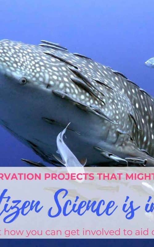
Despite being the largest shark in the ocean there is still so much we need to learn about these gentle giants. Recently progress has been made thanks to photo identification from people all over the world.
Software that was originally used to distinguish star constellations has now been modified to recognise individual spot patterns. One of the biggest projects is being run by Wildbook for Whalesharks. Using photographs of the skin patterning behind the gills of each shark and noting any distinguishing features such as scars, they can distinguish between individual animals.
Between the years of 1992 and 2014 Wildbook for Whale sharks were able to identify 6091 individual animals across 54 different countries. This new data has allowed researchers to discover an additional 7 hotspots.
Wildbook for Whale Sharks has pioneered the way for a new generation of global scale, collaborative wildlife projects that blend citizen science and computer vision to help researchers get bigger and more detailed pictures of some of the world’s most mysterious species.
Jason Holmberg, Information Architect
Without the help of all those volunteers who snapped a quick picture, there would still only be 13 known hotspots of whale sharks. This citizen science information will help determine new areas of conservation importance, further understand their migratory routes and life history, each greatly benefitting the species.

We actually have our own photo identification project here on Koh Tao to monitor visiting individuals, Koh Tao Whale Sharks. If you are lucky enough to see any Whale Sharks on Koh Tao and happen to snap a picture of the animals left hand side, then please submit it to the Facebook group with the date and location.
Project Manta
Project Manta Site – The study can be found here.
Here is another project using the simplicity of photos to help collect data on another mysterious elasmobranch, Reef manta rays. As of June 2018, the Project Manta data base has been able to identify 1235 individuals from 6375 encounters at 31 different sites along the coast. 67% of these photos were submitted by citizen scientists! In more remote regions up to 100% of sightings are sourced through citizen science, proving just how crucial they are for long term studies.
By submitting the photos with their location, date and time, information can be gathered about population size and distribution. The images of the animals’ bellies provide researchers with a spot pattern, unique to each individual. These are compared to past photos to find a match resulting in a logged observation of an identified animal. Or if there are no images with the matching markings then a new individual has been recorded and can be added to the data base.
Recently a wonderful new discovery, thanks to a video submitted from a diver, has shed more light on the migratory behaviour of Reef manta rays. Two male mantas are identified in the video, #736 and #1153, their location is the SS Yongala wreck off the coast of Townsville, Queensland. Upon searching the database these rays were tracked back to a different site, Manta Bommie, North Stradbroke Island, a massive 1150km away. Considering that prior to this discovery the longest documented migration was only 650km, this is a huge discovery in understanding the species behaviour.

It also now provides strong evidence for the need of more marine protected areas to ensure these beautiful animals can travel safely.
OrcaSound
Moving away from photo identification, Orasound instead utilises audio recordings to monitor the population distribution of the southern resident killer whales of the Pacific Northwest, and other resident marine mammals.
Hydrophones are currently placed in three main hotspots within the San Juan Islands to try identify killer whale movement in the area. The audio collected from the hydrophones can be accessed in real time on the website through live recordings 24/7. When a volunteer hears orca calls, other marine mammals or maybe something of interest that can not be identified, they can send the information to Orcasound.
The Aim of OrcaSound is to provide an inexpensive and user-friendly way for people interested in the study and conservation of marine life to participate in research.
Scott Veirs, Bioacoustian and lead researcher
If listeners are unsure what they have heard, there is even an audio library of the resident calls to help practice identifying the calls and improve bioacoustic analysis skills. The real key to the project is that anyone around the world can access the live streams. Therefore, maximizing responses to Orca calls and providing high speed accurate data. A crucial part of studying cetaceans is finding them and quickly alerting research teams to send boats to collect fecal samples or prey fragments. Through this research it has been identified that salmon appear to be the preferred food of choice for the resident pods.

Without the help of citizen scientists, a single research team is relying on limited man power and computer algorithms. The increased man power allows more data to be analysed at a faster rate resulting in more successful tracking of the pods.
